
Page 42: of Marine Technology Magazine (Jun/Jul 2020)
Read this page in Pdf, Flash or Html5 edition of Jun/Jul 2020 Marine Technology Magazine
 41
41
 43
43
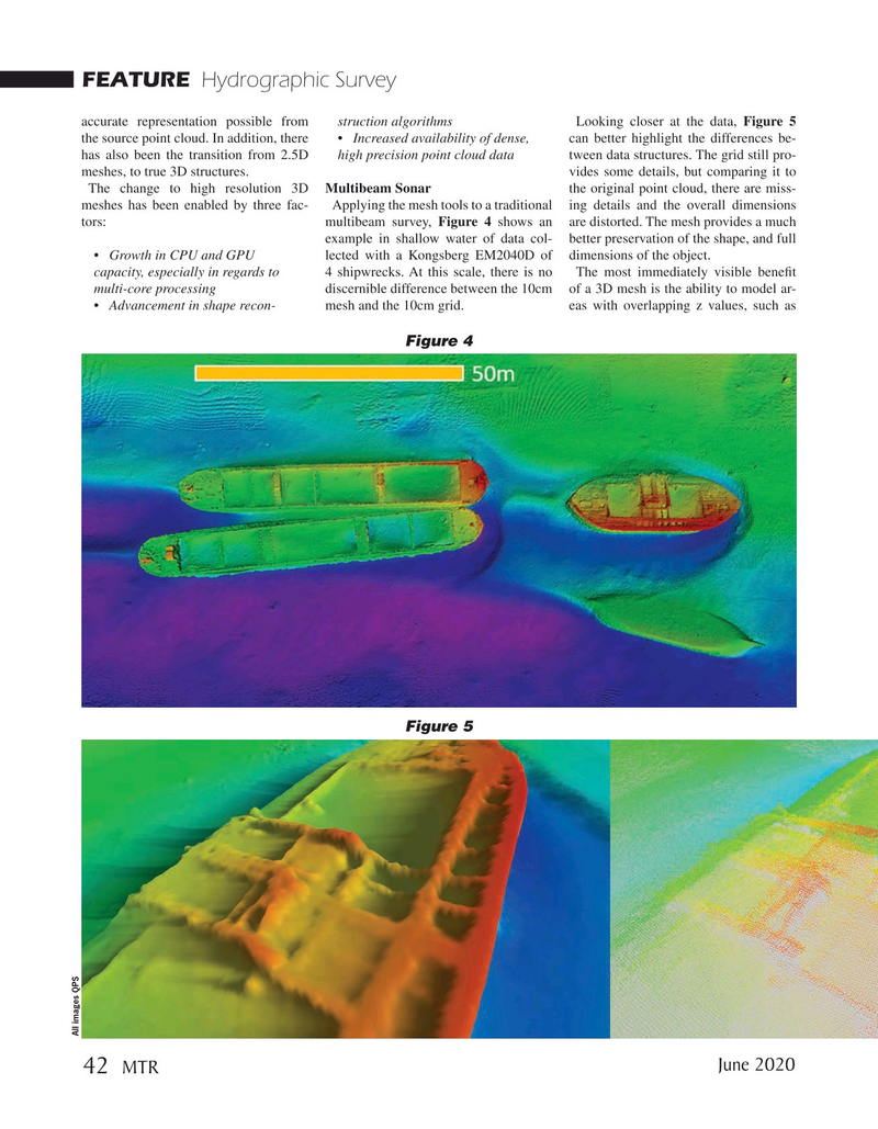
FEATURE Hydrographic Survey accurate representation possible from struction algorithms Looking closer at the data, Figure 5 the source point cloud. In addition, there • Increased availability of dense, can better highlight the differences be- has also been the transition from 2.5D high precision point cloud data tween data structures. The grid still pro- meshes, to true 3D structures. vides some details, but comparing it to
The change to high resolution 3D Multibeam Sonar the original point cloud, there are miss- meshes has been enabled by three fac- Applying the mesh tools to a traditional ing details and the overall dimensions tors: multibeam survey, Figure 4 shows an are distorted. The mesh provides a much example in shallow water of data col- better preservation of the shape, and full • Growth in CPU and GPU lected with a Kongsberg EM2040D of dimensions of the object. capacity, especially in regards to 4 shipwrecks. At this scale, there is no The most immediately visible beneft multi-core processing discernible difference between the 10cm of a 3D mesh is the ability to model ar- • Advancement in shape recon- mesh and the 10cm grid. eas with overlapping z values, such as
Figure 4
Figure 5
All images QPS
June 2020 42
MTR